Subscriber Benefit
As a subscriber you can listen to articles at work, in the car, or while you work out. Subscribe NowBoone County is looking to control its destiny as the Indiana Economic Development Corp. plans the 9,000-acre LEAP Research and Innovation District northwest of Lebanon.
Over the course of three public meetings this year, county officials heard from residents who shared concerns about what the LEAP district and a growing Boone County mean for them, their farmland and their rural way of life.
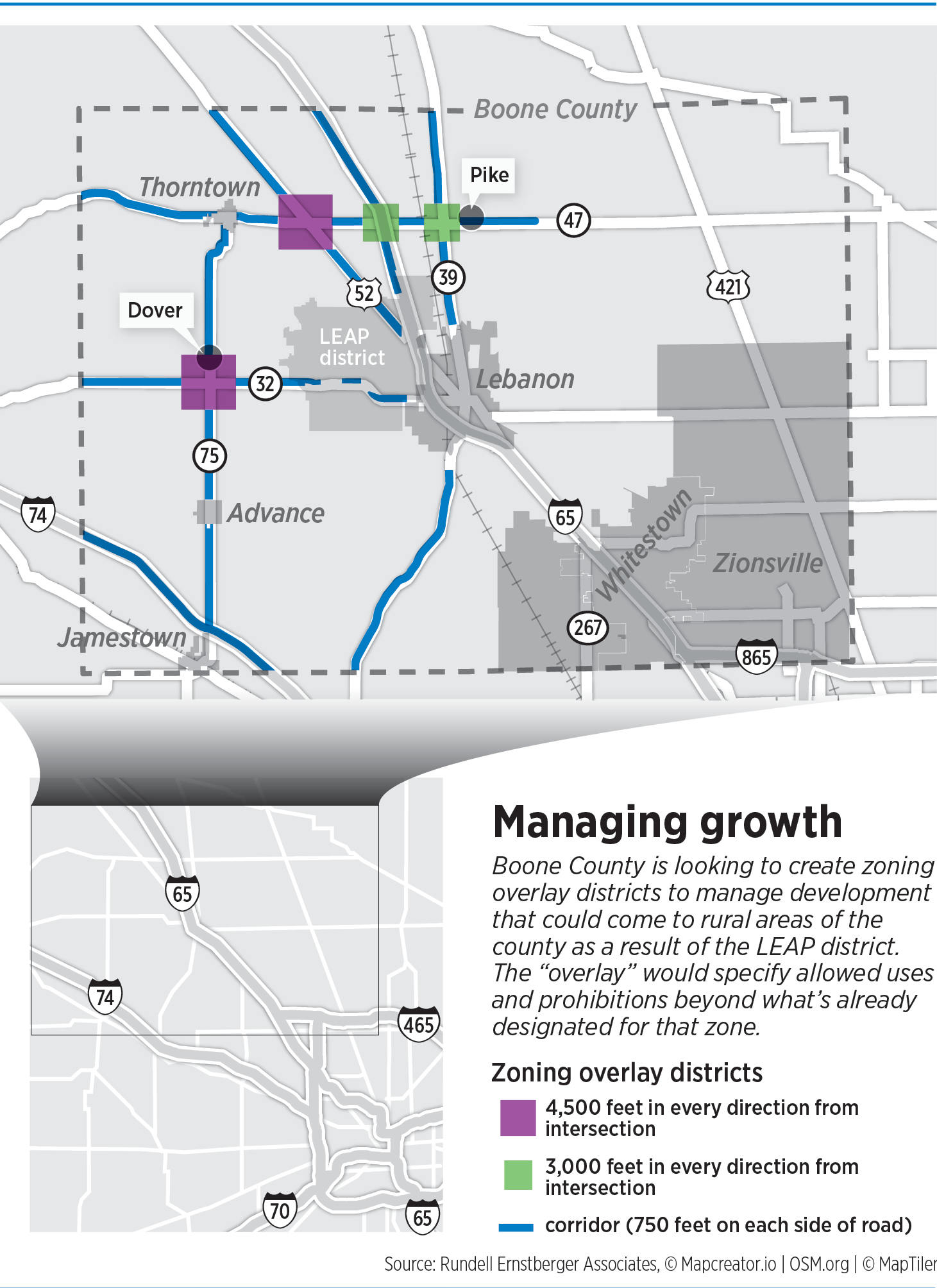
In response to those worries, the Boone County Board of Commissioners in February will review a plan to create what is known as a zoning overlay district along major thoroughfares and across four key intersections in unincorporated areas of the central and western half of the county.
The plan would aim to drive development to those areas to prevent uncontrolled growth from spreading throughout the county, a move that would protect farmland in a county that is largely still rural. The plan also prohibits several types of development in the overlay areas, including manufacturing and warehousing and storage.
The Boone County Area Plan Commission agreed unanimously on Dec. 6 to send the overlay district to the commissioners with a favorable recommendation. The commissioners won’t take the issue up until the new year.
An overlay district is a land-use planning tool that creates a second layer of zoning regulations on top of the primary zoning district. It applies only if someone wants to rezone an area and receives approval.

For example, land that is zoned agricultural will remain agricultural until someone seeks a change in zoning. If a zoning change is granted, the overlay district regulates what types of development are permitted take effect.
“It’s just one more set of tools that people can use to ask the questions that are necessary to know if a bit of development fits where it’s going to go,” Boone County Commissioner Jeff Wolfe said.
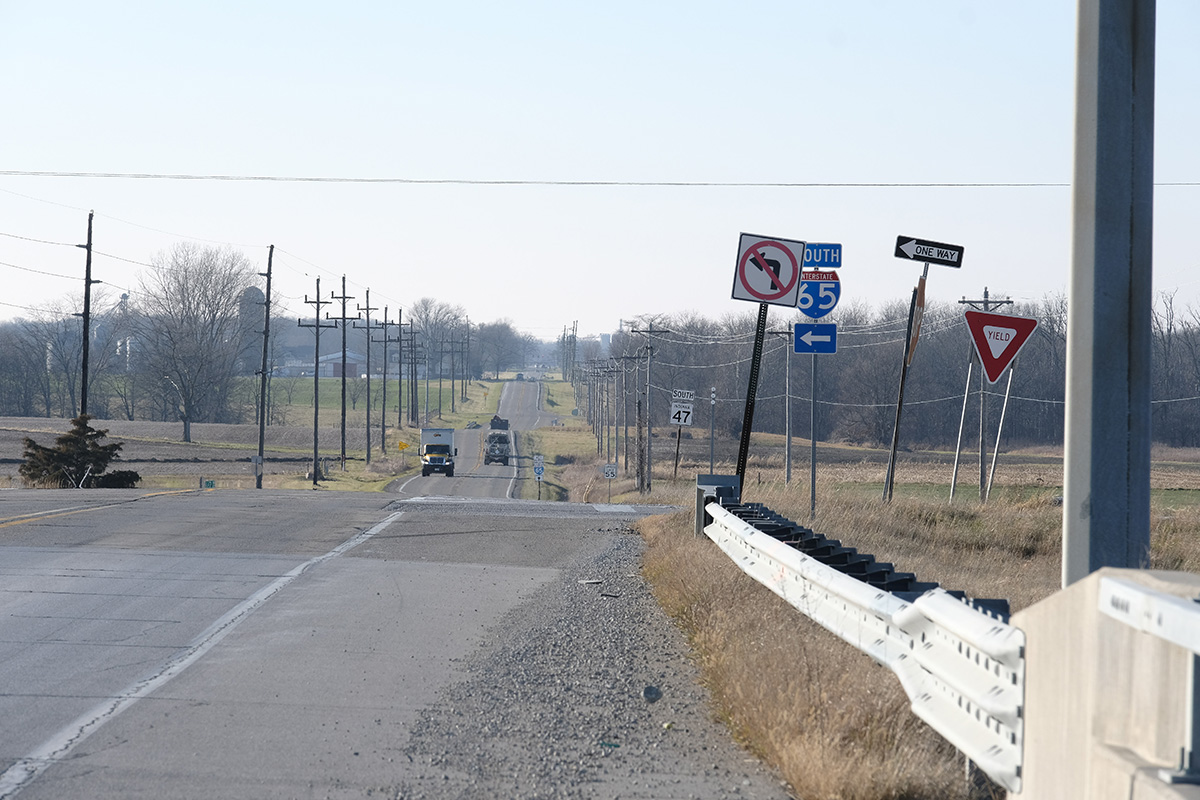
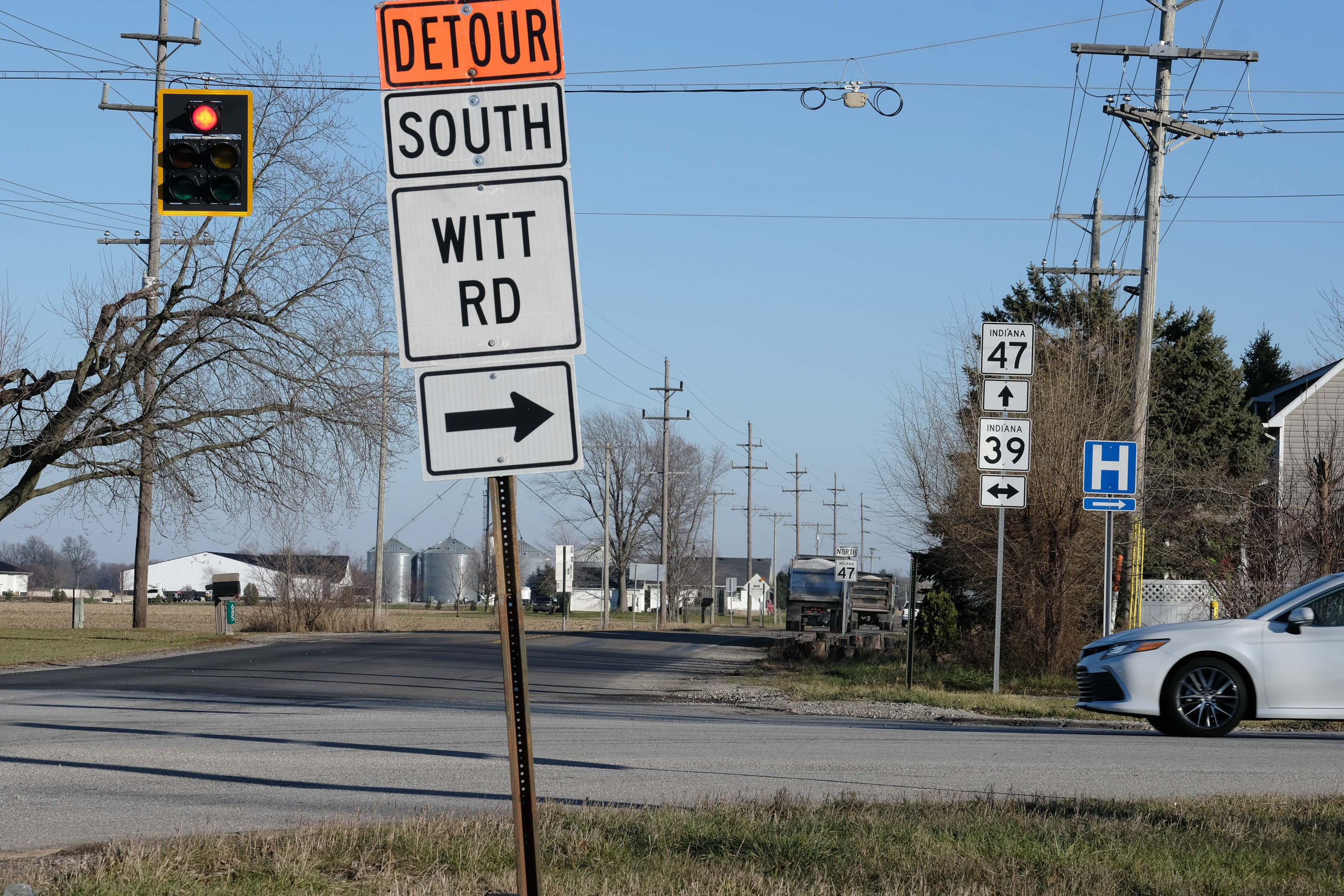
The overlay district would span 750 feet on both sides of some sections of Interstates 65 and 74; U.S. 52; and State Roads 32, 39, 47 and 75, areas that are most suitable for growth.
Four intersections that are likely to experience increased development—Interstate 65 and S.R. 47, U.S. 52 and S.R. 47, S.R. 39 and S.R. 47, and S.R. 32 and S.R. 75—would also be covered by overlay districts.
At the intersection of S.R. 39 and S.R. 47, and at I-65 and S.R. 47, the overlay district would reach 3,000 feet in every direction. At the other two intersections—U.S. 52 and S.R. 47, and S.R. 32 and S.R. 75—the district would stretch 4,500 feet in every direction.
Reaction to LEAP
The decision to study the creation of an overlay district in rural Boone County comes after the IEDC purchased nearly 9,000 acres north and west of Lebanon in its push to create the LEAP district. Since July 2022, Lebanon has annexed nearly 8,000 acres of unincorporated land for the innovation district.
In rural Boone County, where change is largely undesirable, yet potentially inevitable, the concern is about land and how it is used.
Boone County leaders first enlisted Indianapolis-based Rundell Ernstberger Associates to create a planned unit development in the LEAP district area. (A planned unit development, or PUD, is another land-use tool that defines and regulates proposed development and guides developers on permitted uses and design standards.)

However, once Lebanon began annexing LEAP district territory into its city limits, the county lost control of that area and shifted its focus to creating the overlay districts in areas that leaders predict will see development in the coming years. The overlay district would not prevent a city or town from annexing land within it.
Despite that, Cynthia Bowen, a planner with Rundell Ernstberger Associates who is working with the county to create the overlay district, said the overlay district is the best way to protect remaining agricultural land in Boone County.
“They wanted to manage that growth and protect the agricultural land that was going to be left in the county,” Bowen said. “And so, when that kind of switched when everything was annexed into the city, their goal was still to protect agricultural land.”
 It’s clear, she said, that all areas of Boone County will see “spin-off growth.” And the county is limited in the tools it can use because so much land around the LEAP district has been annexed into Lebanon.
“We knew that there needed to be some type of relief valve that would accommodate some growth and where the best areas in the county [were] that could handle that growth,” Bowen said. “And that would have been along the state road corridors as well as at those intersections.”
Protecting rural character
A planning document for the overlay district lists dozens of potential uses and whether they would be permitted, require a special exemption or development plan approval from the area plan commission, or be prohibited.
For example, while agriculture and residential uses are largely allowed, prohibited uses include manufacturing, distribution, freight trucking, junkyards, warehousing and storage, solar power structure construction, sludge disposal, and mining.
And in some cases, what’s allowed in some locations is prohibited in others. For example, farm equipment sales and services would be allowed along state roads 32, 39, 47 and 75 but prohibited elsewhere.

Stephen Elkins, executive director of the Boone County Area Plan Commission, said the idea is to focus and channel growth.
Elkins has led the county’s planning commission since March. Before that, he spent seven years in Colorado as a project planner for the city and county of Denver.
“The general idea is to protect the agricultural and rural character of the majority of those lands,” he said.
Boone County began experiencing rapid growth even before planning began on the LEAP district.
The county’s population is up 29% since 2010, the second-highest growth rate in Indiana and the 68th-highest in the nation. Its median household income is rising and now tops $92,000, second only to Hamilton County statewide. Commercial and industrial developments are exploding along Interstate 65, bringing hundreds of new jobs every year.
Second attempt
Boone County officials tried and failed to create an overlay district in 2013. That district would have stretched along Interstate 65 from north of the Lebanon city limit to the boundary with Clinton County. Wolfe said the plan died following opposition from residents and landowners who felt it represented unwanted change.
Brian Daggy, a Boone County resident and board member of the Boone County Preservation Group—which was formed in response to plans for the LEAP district and developing the county’s farmland—told plan commission members at the Dec. 6 meeting that he was in favor of the overlay district.
“I want to compliment you all on sticking with this and working with these folks,” Daggy said. “I overall support what you’re doing, and I’ll help support it if I can.”
But Gary Artman of Lebanon told commissioners he opposes the overlay district because it represents government overreach.
“I took the time and effort to talk to several landowners, even landowners that have no intention and do not want to develop their property,” Artman said. “They do not want this commission or the county commissioners to direct them as to what they can and can’t do with their property.”
Area Plan Commission member Tad Braner responded to Artman’s comment later in the meeting, saying it is important for Boone County to prepare for the inevitable development coming to rural areas of the county.
He noted the development that has come to formerly rural areas east of Columbus, Ohio, where Intel is investing $20 billion to build a computer chip facility.
“Change is coming, whether we like it or not. The game is being played much larger than any of us have any idea,” Braner said. “It’s going to take a long time to probably get all the utility stuff worked out and everything. It’s not going to happen overnight, but it is going to happen.”•
Please enable JavaScript to view this content.
If the aim is to channel growth, would TIF districts not be more effective than restrictive zoning classifications?