Subscriber Benefit
As a subscriber you can listen to articles at work, in the car, or while you work out. Subscribe Now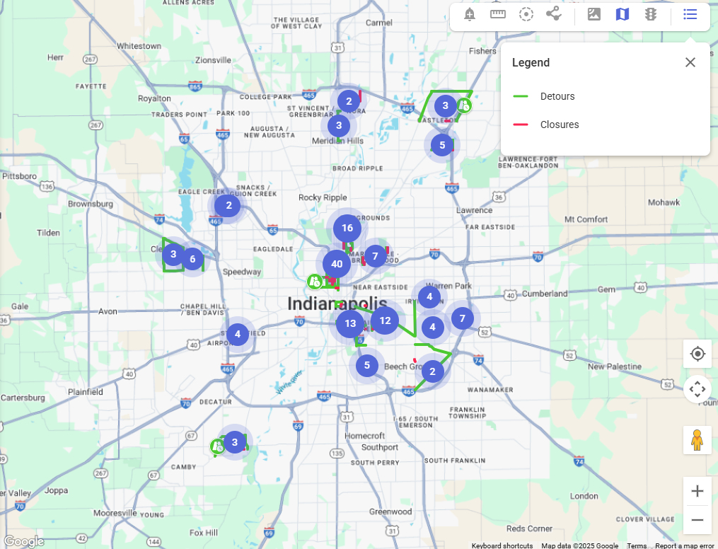
The city of Indianapolis on Wednesday launched a new tool that allows the public to view current and upcoming road closures.
The website, at roadclosures.indy.gov, allows users to search addresses and view a map that details road projects, right-of-way permits and special events. It uses and displays data from Indianapolis’ Department of Public Works and the Department of Business and Neighborhood Services.
The public can also use the tool to view active permits and Business and Neighborhood Services enforcement actions.
The platform will be updated daily. The tool includes the names of the project and the permit holder, a project description and start and end dates. Users can also set up custom notifications for selected areas on the map to be notified about when permits are activated within those boundaries.
It also includes work that is in progress or scheduled to occur.
The Department of Business and Neighborhood Services launched the site as part of the Hogsett administration’s commitment to make government service and information easier to access, according to director Abbey Brands.
“This user-friendly format empowers citizens to stay informed and engaged in the work and events impacting their communities,” Brands said in a news release.
Please enable JavaScript to view this content.
Good idea. Now do it for zoning requests.
needs work. the detour for an upcoming 82nd street project to remove rail lines in Castleton takes you to 96th street, which is facing closures for a project between Masters and I-69. And while its not a city project, there doesn’t seem to be any mention of the reconstruction of I-69 and 465 interchange. That might be helpful, as folks have to detour around that mess much of the time. But a good start…
Does not show the total closure of Illinois St. from South to Georgia…which has been closed for about a year now for construction of the Signia Hotel. It also does not show the total closure of 22nd between Illinois and Capitol.
How much of the rest of it is also missing or wrong?